


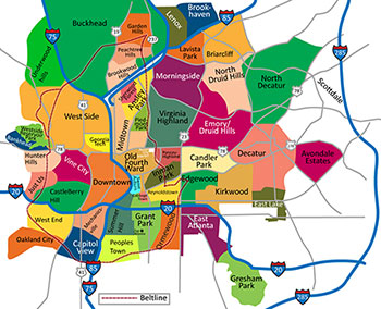
Click Map for Atlanta Intown Map (full size)
Metro Atlanta is broadly defined by the terms ITP (Inside The 285 Perimeter beltway) and OTP (Outside The 285 Perimeter beltway). ITP can be segmented by our freeway system into 6 areas: NE (north of I-20 and east of the 75/85 Connector); NW (north of I-20 and west of the 75/85 Connector); SE (south of I-20 and east of the Connector); SW (south of I-20 and west of the Connector), the Buckhead Neighborhoods (north of the 75/85 Connector split, between the two freeways and south of the 285 beltway); and, finally Downtown around which it all circles.
The NE sector (area of expertise) includes the following cities and neighborhoods: Midtown, Ansley Park, Sherwood Forest, Morningside/Lenox Park, Virginia Highland, Poncey Highland, Old Fourth Ward, Candler Park, Inman Park, Lake Claire, Druid Hills, Emory, Decatur, Toco Hills, Piedmont Heights, La Vista Park, Cabbagetown, Reynoldstown, Edgewood, Kirkwood, East Lake and many others.
NE Atlanta (Wikipedia, Public Domain)
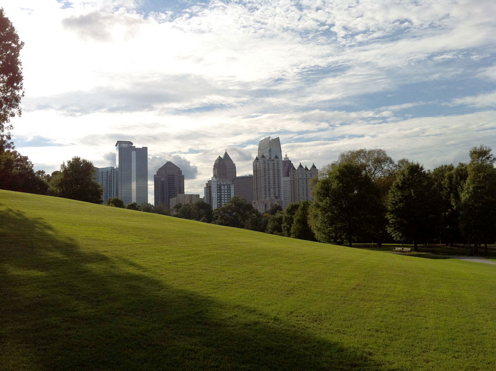
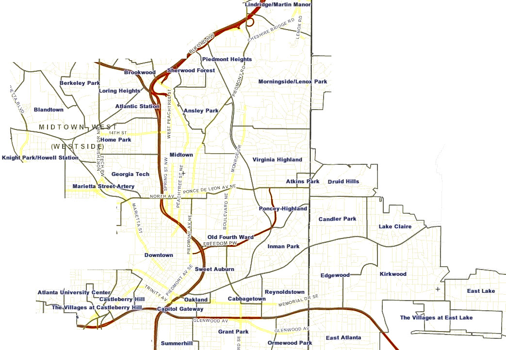
Piedmont Park is surrounded by Midtown,
Virginia Highland and Ansley Park.
The NW area includes (eastern segment is area of expertise): Atlantic Station, Home Park, Georgia Tech and Technology Square, Loring Heights, and Berkeley Park, Blandtown, Knight Park/Howell Station, Marietta Street Artery and others.
NW Atlanta (Wikipedia, Public Domain)
The SE neighborhoods include: (northern segment is area of expertise) East Atlanta, Grant Park, Summerhill, Ormewood Park, Peoplestown, South Atlanta, Lakewood Heights and more.
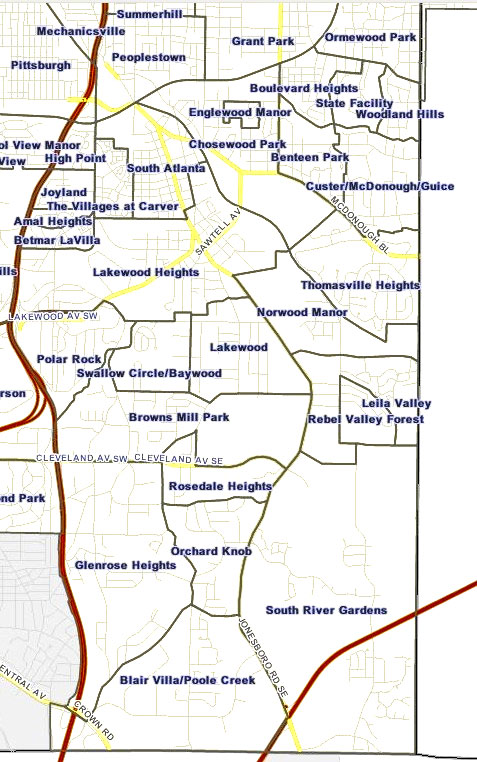
SE Atlanta (Wikipedia, Public Domain)
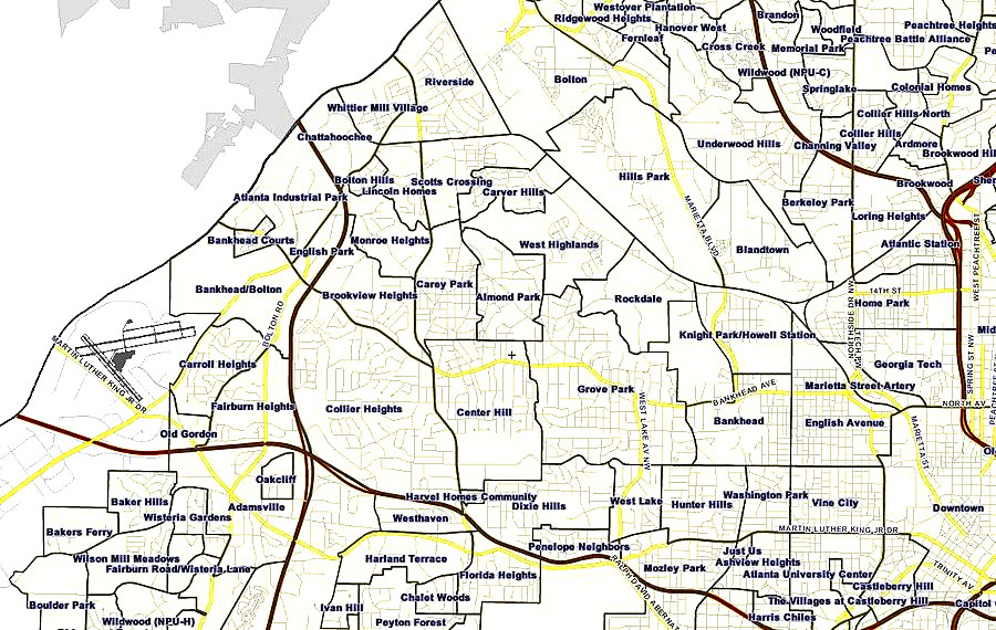
The SW corridor is home to: West End, Mechanicsville, Pittsburg, Adair Park, Oakland City, Cascade Heights and more.
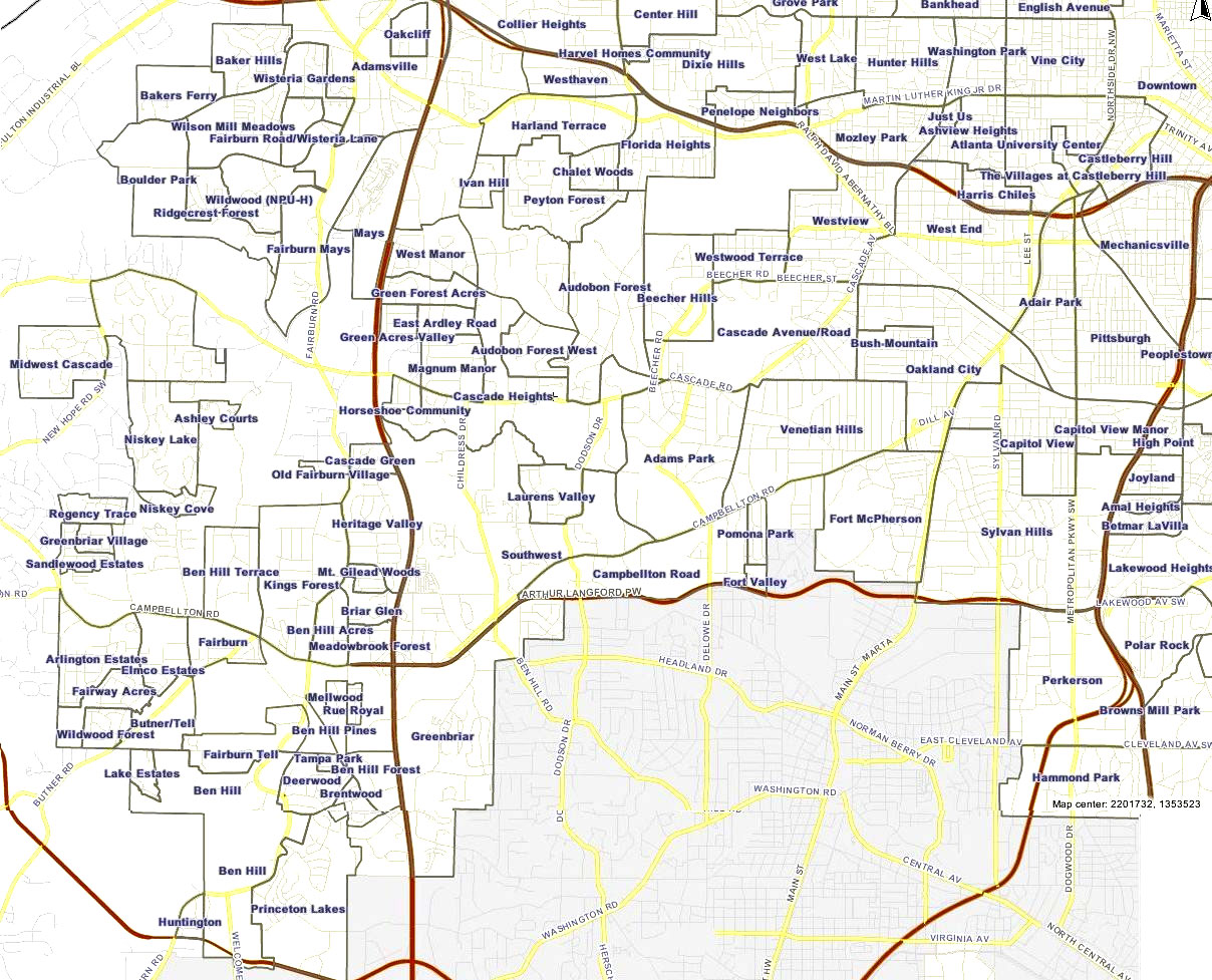
SW Atlanta (Wikipedia, Public Domain)
Downtown Atlanta (area of expertise) includes the neighborhoods of: Castleberry Hill, Centennial Hill district, Five Points district, Hotel District, Luckie Marietta district, Peachtree Center, SoNo and South Downtown.
Buckhead Neighborhoods (area of expertise) are comprised of: Buckhead, Garden Hills, Peachtree Hills, Lindridge/Martin-Manor, Brookwood Hills, Collier Hills, Peachtree Park, Peachtree Battle, Tuxedo Park, Chastain Park, West Paces Ferry/Northside, Brookhaven, North Buckhead, Mt Paran/Northside and MANY more…
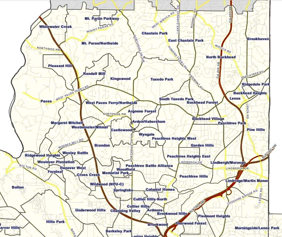
Buckhead (Wikipedia, Public Domain)

The Atlanta BeltLine is the most comprehensive revitalization effort ever undertaken in the City of Atlanta and among the largest, most wide-ranging urban redevelopment and mobility projects currently underway in the United States. This sustainable project is providing a network of public parks, multi-use trails and transit by re-using 22-miles of historic railroad circling downtown and connecting 45 neighborhoods directly to each other. Visit the BeltLine website for more information.
The total length will be 22 miles (35 km), running about 3 miles (5 km) on either side of Atlanta’s elongated central business district. It is connecting some of Atlanta’s oldest neighborhoods and reinvigorating a community spirit. Older parks are getting facelifts and are expanding (like Maddox Park, and Ardmore), while new parks are being introduced, including the spectacular Historic Old Forth Ward Park, adjacent to the BeltLine and Ponce City Market. View the BeltLine Trail Maps (PDF).
At the Atlanta Bicycle Coalition, we’re your voice for better biking! Our mission: To create a healthier, more sustainable Atlanta by making it safer, easier, and more attractive to bicycle for fun, fitness, and transportation. Our vision: Bicycling helps everyone, not just those who ride bicycles, by creating a higher overall quality of life through improved public health, cleaner air, less congestion, and stronger communities.
Learn about ongoing bike lane and related projects
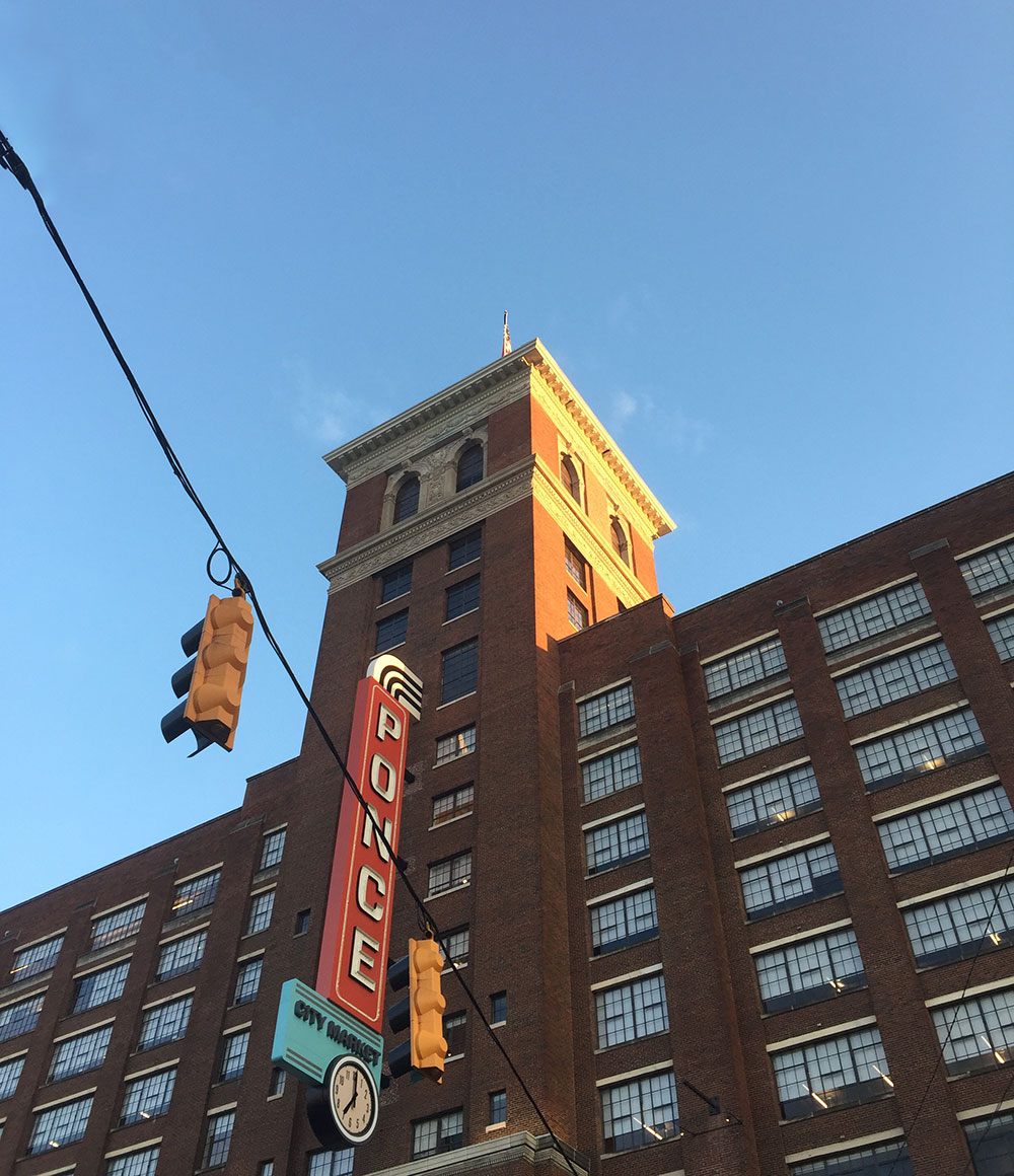
Ponce City Market
In the 1920s, Sears, Roebuck and Co. built their Atlanta regional headquarters on Ponce De Leon Avenue, which served the Southern States of the US. After years of service, the City of Atlanta’s largest building, was closed down and eventually re-purposed for use as Atlanta’s City Hall. However, in 2010, Jamestown (the visionary development company who re-purposed the now popular Chelsea Market in Manhattan, NY) purchased the building and are currently transforming the structure as the largest adaptive reuse project in Atlanta’s history.
Ponce City Market is restoring 1.1 million square feet, creating a vibrant urban centerpiece that combines 300,000 square feet of retail and restaurants, 450,000 square feet of office space and 260 residential units. It has (Septemer 2015) direct access to the Beltline, and faces, on one side, Ponce De Leon Avenue and, on the other, The Historic Old Forth Ward Park.
To get the latest of what stores and restaurants are now open at Ponce City Market, check out the PCM directory.


